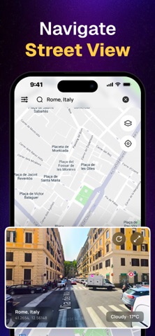
See any street, city, or landmark on Earth in vivid 3D — without leaving your seat.
3D Earth GPS Maps turns your phone into a window on the world. Explore real street-level imagery, live satellite maps, and full 360° panoramas, then switch map styles, check your compass, and search any place on the planet in seconds.
Perfect for travelers, explorers, students, and the endlessly curious.
3D Earth & Satellite View
Zoom from outer space down to the sidewalk. Browse high-resolution satellite imagery of cities, coastlines, mountains, and landmarks worldwide.
Real Street View
Walk down actual streets with immersive panoramic imagery. Look around, move ahead, and see places as if you were standing there.
360° Panoramas
Dive into full 360-degree views. Filter imagery by date or contributor for richer, more personal exploration.
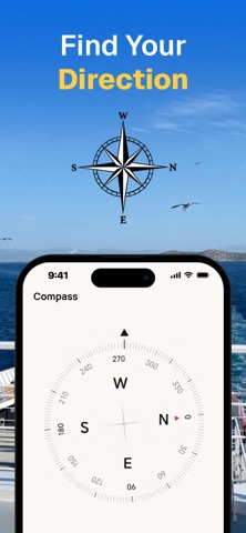
Instant Compass
Know exactly which way you're facing. A precise digital compass shows your heading, latitude, and longitude in real time.
Choose Your Map Style
Switch between Light, Dark, OpenStreetMap, Navigation, and Satellite base maps to see the world your way.
Smart Map Layers
Reveal detected traffic signs, points of interest, and place categories right on the map.
Fast Search
Type any address, city, or landmark and jump straight to street or satellite view.
Why you'll love it
- Explore anywhere on Earth in 3D
- Real street-level and 360° imagery
- Clean, fast, and easy to use
- Ideal for trip planning, learning, and discovery
- Works for big cities and remote corners alike
Download 3D Earth GPS Maps: Street View and start exploring the world today.
Your payment will be charged to your iTunes Account as soon as you confirm your purchase.
Privacy Policy: https://sanketrolaappstore.blogspot.com/2024/06/privacy-policy.html
Terms of use: https://sanketrolaappstore.blogspot.com/2024/06/terms-of-use.html