Track wildfire activity in near real-time on a single, layered map, and get fire alerts when satellites detect a new hotspot near the places you watch. Fireguard pulls data from NASA, NOAA, NIFC, NWS, and other authoritative sources so you can see what's burning, where it's headed, and how conditions are changing.
WORLDWIDE LAYERS
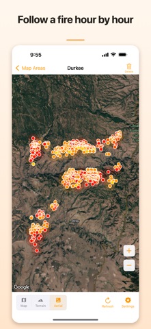
• Satellite hotspot detections from Suomi-NPP, NOAA-20, NOAA-21 (VIIRS 375 m) and Terra (MODIS 1 km)
• Satellite ground-track overlays showing upcoming sensor passes
• Low-confidence hotspot filter to reduce false positives
UNITED STATES LAYERS
• GOES geostationary fire detections
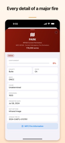
• Active fire perimeters and WFIGS interagency boundaries
• InciWeb incidents, wildland dispatch reports, and new-start ignitions
• ICS-209 large-incident tracking with assigned resources
• Satellite-derived emerging fire polygons
• Cal Fire California incidents
• NOAA smoke plume areas
• Red Flag Warnings, Fire Weather Watches, and SPC Day 1 Outlook
• Dry thunderstorm risk areas
• Air Quality Index (AQI) monitoring stations with PM2.5 and ozone
• Live fire camera feeds (ALERTCalifornia)
• Real-time traffic conditions
INTERNATIONAL LAYERS
• Canada active wildfires by province (NRCan CWFIS)
• Australia NSW Rural Fire Service major incidents
• Europe, Mediterranean, and Middle East fire perimeters (EFFIS)
DESIGNED FOR EVERYONE
• No account, login, or subscription required
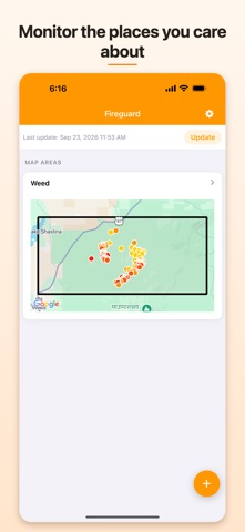
• Monitor up to 3 map areas at once — pick a city or use your current location
• Tap any marker or polygon for a detailed breakdown with source links
• Toggle layers on or off to build the view you need
Anyone in or near a fire-prone area — residents, first responders, ranchers, travelers, or people watching out for family — gets a clearer picture of what's happening, faster.
Fire alerts follow satellite passes: detections typically arrive 1–4 hours after a fire starts. Fireguard is not an official warning system. Always follow instructions from local authorities.